Mystic Beach & the Juan de Fuca Day Hike
Mystic Beach is the short, wild hike that ends at a waterfall falling onto the sand. Here is the trailhead, the walk, the tides that matter once you arrive, and how it fits the wider Juan de Fuca coast west of Victoria.
Mystic is easiest independently with a car. Without one, compare guided Victoria coast days after planning tides and footwear.
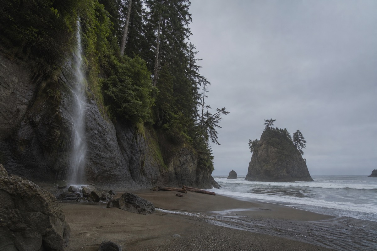
The trail to Mystic Beach starts in ordinary second-growth forest off a gravel parking lot, drops across a creek on a swaying suspension bridge, then opens without warning onto a cove where a waterfall pours over a sandstone bluff straight onto the sand. It is the most photographed beach on the Juan de Fuca coast, and the walk in is short enough that families and first-time hikers reach it, yet forested and rooty enough to feel like a real trek. This guide covers the trailhead, the hike itself, the tides that matter once you arrive, and how Mystic fits into the wider run of beaches west of Victoria.
How far you walk to each Juan de Fuca beach
Approximate one-way walk times from each trailhead; real times vary with fitness, mud and trail conditions, so check current tide and trail notes before you go.
Where is Mystic Beach and how do you reach the trailhead?
Mystic Beach lies on the wild Juan de Fuca coast southwest of Sooke, reached from the China Beach parking area off Highway 14 in Juan de Fuca Provincial Park. From downtown Victoria, plan on roughly one to one and a half hours of driving, then a forest walk of about two kilometres down to the sand.
Highway 14, the West Coast Road, is the single route out to this coast. It runs from Victoria through Sooke and then narrows into a winding two-lane road that hugs the shoreline all the way to Port Renfrew. The China Beach parking lot, where the Mystic Beach trail begins, sits a few kilometres before you reach Sombrio and well before Port Renfrew. It is a day-use lot with pit toilets and no services beyond that, so fuel up and grab food in Sooke, the last real town on the way. There is no reliable cell coverage once you pass Sooke, so download your maps and your tide table before you leave. For the bigger picture of reaching the island in the first place, our guide to getting to Vancouver Island by ferry and seaplane covers the crossing, and if Victoria is your base, things to do in Victoria fills out the rest of your stay.
The lot fills early on sunny summer weekends, and cars overflow onto the highway shoulder when it does. An early start or a shoulder-season visit both help. Juan de Fuca Provincial Park is managed by BC Parks, and the official BC Parks pages carry the current access, closure and camping notes worth checking before you drive out. Day use is free; only overnight backcountry camping needs a permit.
| From | Approx distance | Allow (drive) | Notes |
|---|---|---|---|
| Victoria | About 70 km | 1 to 1.5 hrs | Via Sooke on Highway 14 |
| Sooke | About 35 km | 35 to 45 min | Last fuel, food and cell service |
| Port Renfrew | About 40 km | 40 to 50 min | Approach from the western end of Highway 14 |
| Nanaimo | About 175 km | 2.5 to 3 hrs | Via Victoria; a long day out and back |
What is the Mystic Beach hike actually like?
The Mystic Beach hike runs about two kilometres each way, roughly 45 minutes at a steady pace, on a rooty forest trail with gentle ups and downs, one suspension bridge over a ravine, and a short steep descent to the sand at the end. It is rated easy to moderate, and most reasonably active walkers, children included, manage it comfortably.
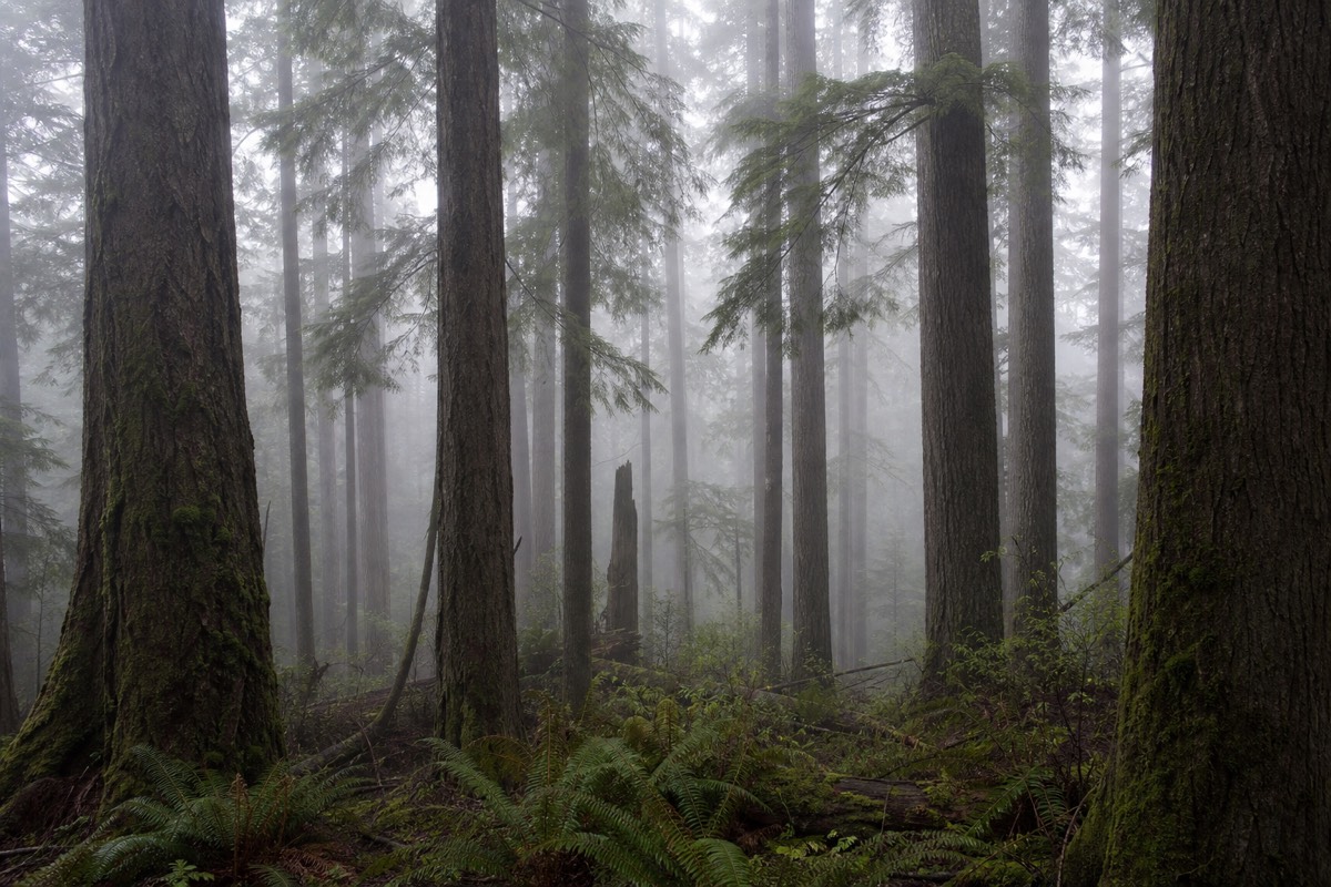
The path leaves the China Beach lot and climbs briefly into coastal forest of hemlock, cedar and salal before rolling downhill toward the water. It is a genuine forest trail rather than a groomed boardwalk: expect exposed roots, muddy patches that linger long after rain, and a few sections of plank walkway over the wettest ground. The suspension bridge, strung across a forested ravine partway in, is the trail's landmark and sways enough to slow a nervous first-timer. Near the end the path drops steeply, with a rope and worn steps in places, onto the beach itself.
The cove is the payoff. A seasonal waterfall spills over the sandstone bluff at the eastern end, falling onto the beach where children stand under it on warm days, and the soft rock has been eroded into shallow caves and overhangs you can walk into. A rope swing often hangs from a tree above the sand, though whether it is present and sound changes from season to season, so treat it with caution. This is a properly wild beach with no lifeguards and no facilities, and the surf can be strong. If you are building a day of trails rather than just this one, see our roundup of the best hikes on Vancouver Island, and the longer route it belongs to in our West Coast Trail and Juan de Fuca Marine Trail guide.
| Detail | Mystic Beach |
|---|---|
| Distance | About 2 km each way (4 km round trip) |
| Time on trail | Roughly 45 min each way at a steady pace |
| Difficulty | Easy to moderate |
| Terrain | Rooty forest path, mud, some boardwalk, one suspension bridge |
| Finish | Short steep descent with a rope and steps to the sand |
| Highlights | Waterfall onto the beach, eroded sandstone overhangs, rope swing when present |
| Facilities | Pit toilets at the parking lot only, none on the beach |
When is the best time to hike to Mystic Beach?
July and August are the driest and warmest but the busiest, with the parking lot filling by mid-morning. May, June and September give you decent weather with far fewer people. Winter is wet, muddy and dramatic. Whatever the month, check the tide table, because a high tide pushes the sea up against the bluffs and shrinks the usable beach.
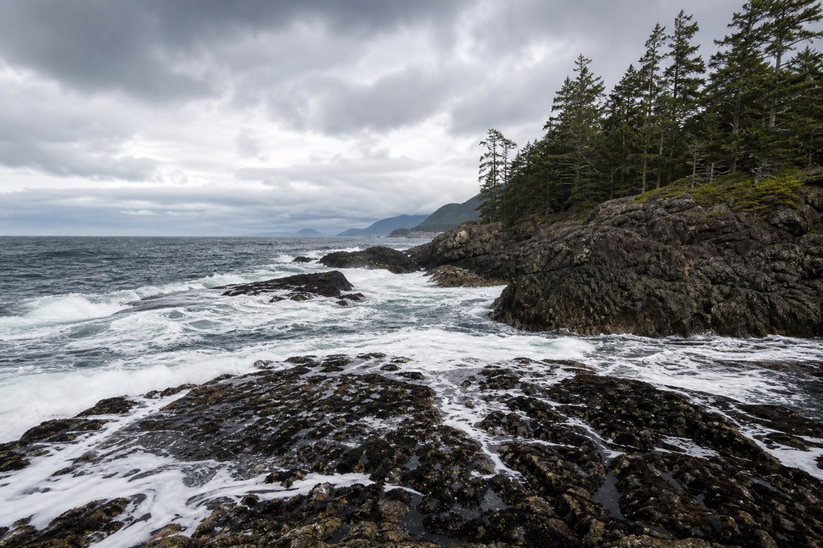
Summer is the obvious window if you want to stand under the falls or wade, though even in August the water off this coast stays cold. The trade is crowds and parking pressure, so arrive early or late in the day. The shoulder months of May, June and September are the sweet spot for many visitors: the forest is green, the trail is firmer than in the wet season, and you often have long stretches of sand to yourself. To weigh the months across the whole island, see our take on the best month to visit Vancouver Island and the fuller Vancouver Island weather month by month breakdown.
Winter turns the trail into a mudbath and the beach into a storm-watching stage, with the waterfall at its fullest after heavy rain. It can be genuinely beautiful and genuinely miserable in the same afternoon, so go prepared or wait for a clear break. The one constant in every season is the tide. On a big high tide the sand all but disappears at the base of the bluffs, and a rising tide can pin you against the rock at the far end of the cove, so plan your walk around a falling or low tide.
| Season | Conditions | Crowds | Verdict |
|---|---|---|---|
| Jul to Aug | Warm, driest, firm trail | Busy, lots fill early | Great weather, arrive early |
| May to Jun | Mild, green, mostly dry | Moderate | Excellent balance |
| Sep to Oct | Mild, some rain later | Quieter | Quiet and often lovely |
| Nov to Apr | Wet, muddy, big surf | Very quiet | Dramatic but demanding |
What should you pack and know before you go?
Pack for wet feet and changeable weather even on a sunny forecast: grippy footwear, layers, a waterproof shell, water and snacks, and a tide table for the day. There is no drinking water and no store on the trail, this is black bear and cougar country, and everything you carry in has to come back out.
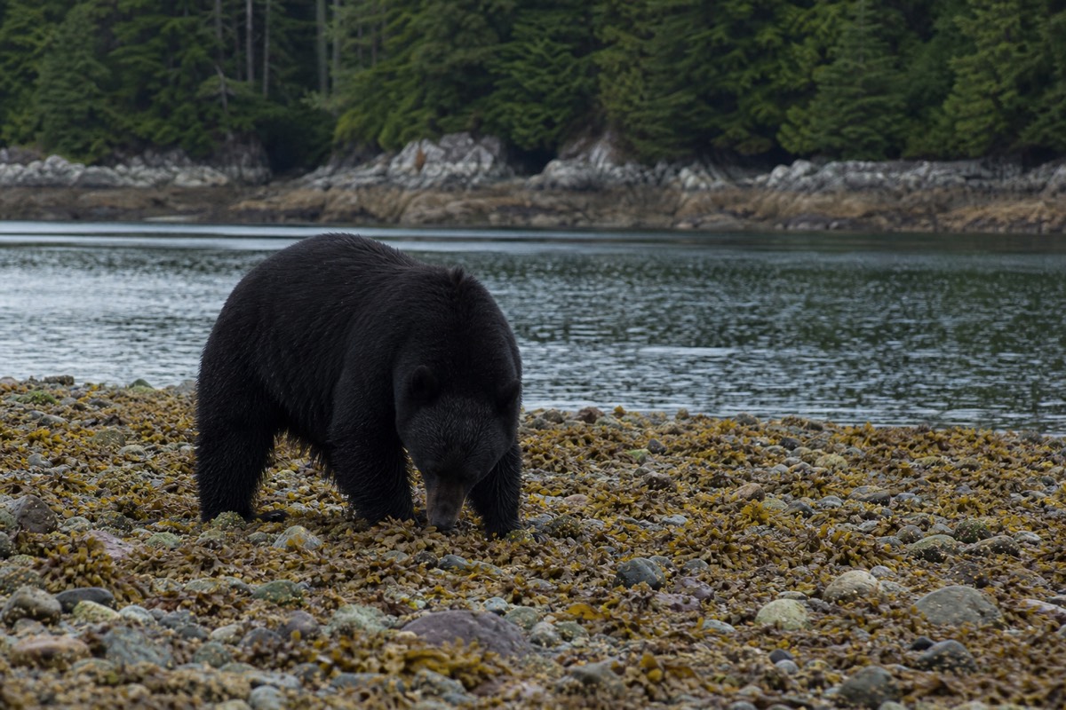
Footwear matters most. The forest sections stay muddy long into summer, and the final descent to the sand is slick, so proper trail shoes or light boots beat sandals every time. Layers and a rain shell handle the coast's habit of turning grey and windy without notice. Carry your own water, since there is none on the route, and pack out all rubbish, including anything you find, because there are no bins. Wildlife is a real consideration on the island: black bears and cougars both live in these forests, so make noise on the trail, keep children close, and never leave food unattended on the beach. Families weighing this hike against gentler options will find our notes on whether Vancouver Island is good with kids useful, and the wider best beaches on Vancouver Island guide lists calmer, easier sand.
One more practical note: cell service is unreliable past Sooke, so tell someone your plan and expected return, and do not count on a phone signal at the beach. A headlamp is worth carrying if there is any chance you will still be on the trail near dusk, as the forest darkens quickly.
| Bring | Why |
|---|---|
| Grippy trail shoes or light boots | Muddy forest and a slick descent to the sand |
| Layers and a waterproof shell | Coast weather changes fast in any season |
| Water and snacks | No drinking water or store on the trail |
| A tide table for the day | High tide shrinks the beach against the bluffs |
| Rubbish bag | No bins; pack out everything you carry in |
| Headlamp | The forest darkens quickly late in the day |
How does Mystic Beach fit into the Juan de Fuca Marine Trail?
Mystic Beach is the first beach on the Juan de Fuca Marine Trail, a rugged 47-kilometre route that runs from the China Beach trailhead west to Botanical Beach near Port Renfrew. The trail has four road access points, and Mystic is both an easy day-hike destination and a popular first-night backcountry campsite for through-hikers.
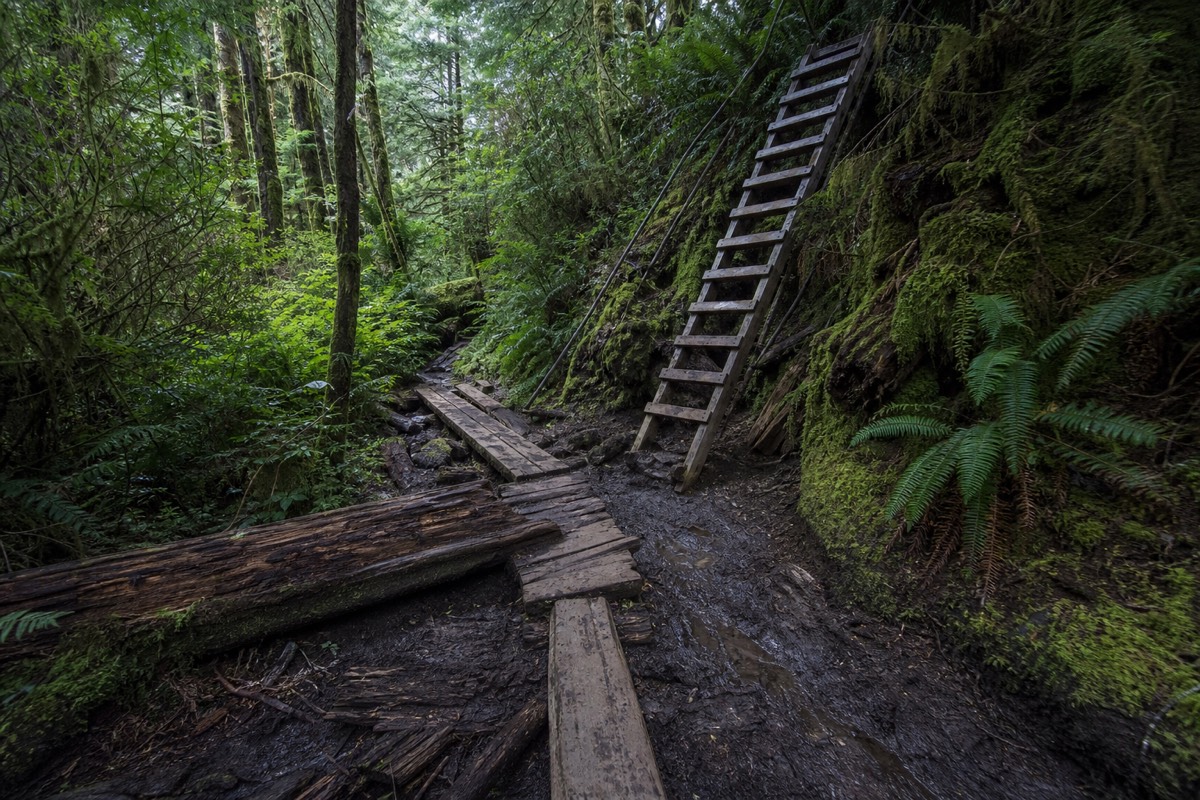
Most people who walk to Mystic never touch the rest of the marine trail; they do the out-and-back from China Beach and drive home. But the same path continues west toward Bear Beach and beyond, growing steadily wilder and more demanding as it goes. Through-hikers often make Mystic Beach their first camp, pitching a tent above the high-tide line and starting the harder sections the next morning. If you want to camp, a backcountry permit and fee apply through BC Parks, and you carry in everything, including water and a way to hang food. This is a real wilderness route, not to be confused with the far longer and more serious West Coast Trail farther north, which we cover in our Juan de Fuca and West Coast Trail hiking guide.
The four road access points let you sample the trail without committing to the whole thing. China Beach at the eastern end reaches Mystic in under an hour; Sombrio and Botanical give you the middle and western sections. Distances below are the widely used approximate trail markers, and the BC Parks signage at each trailhead is the authority to trust over any map.
| Access point | Approx trail marker | Good for |
|---|---|---|
| China Beach (east end) | Km 0 | Day hike to Mystic Beach |
| Sombrio Beach | About km 29 | Surf, waterfall canyon, camping |
| Parkinson Creek | About km 37 | Quiet mid-trail access |
| Botanical Beach (west end) | Km 47 | Tidepools, Port Renfrew base |
How does Mystic compare to the other Juan de Fuca beaches?
Mystic is the wild-hike-to-a-waterfall beach. China Beach is the easy ten-minute stroll to broad sand, Sombrio is the local surf spot with a hidden waterfall canyon, and Botanical Beach near Port Renfrew is the tidepool destination. Each has its own trailhead off Highway 14, so many visitors string two or three together in a day.
If your priority is the classic waterfall-onto-the-beach photo and you do not mind a proper forest walk, Mystic wins. If you have small children or limited time, China Beach is the gentler choice, a short walk through big trees to open sand. Surfers head to Sombrio, and anyone chasing sea stars and anemones drives on to Botanical, where the rock shelves fill with intertidal life at low water. We cover those two in detail in our guide to China Beach and Sombrio Beach and our Botanical Beach tide pools guide, and the waterfalls theme continues inland in our Vancouver Island waterfalls roundup.
Because the trailheads sit within an hour of one another along Highway 14, a well-planned day can take in Mystic in the morning and Botanical at the afternoon low tide, or Mystic and Sombrio back to back. The limiting factors are parking and the tide, not distance. Start early, watch the tide table, and you can see more of this coast in a day than most visitors realise.
| Beach | Walk in | Best for | Water |
|---|---|---|---|
| Mystic Beach | About 45 min (2 km) | Waterfall, wild cove, rope swing | Wade, cold |
| China Beach | About 10 min | Easy sand, families | Wade, cold |
| Sombrio Beach | About 10 to 15 min | Surf, hidden waterfall canyon | Surf, cold |
| Botanical Beach | About 15 to 20 min | Tidepools at low tide | Rock pools |
Who should hike to Mystic Beach, and when does a tour make more sense?
Independent visitors with a car, a tide table and proper footwear will love Mystic as a half-day out from Victoria. Travellers without a car, or those who want the driving, the wildlife spotting and the tide timing handled, are usually better served by a guided day out to the wild west-coast beaches near Port Renfrew.
The self-drive version is straightforward: pack well, leave early, watch the tide, and give the winding highway more time than the map suggests. If you would rather leave the logistics to someone else, a guided west coast seals, rainforest and waterfall day tour from Victoria visits this same stretch of coast, with a stop among thousand-year-old cedars at Jurassic Grove and beaches with dramatic sandstone formations and possible seal, sea lion and eagle sightings. It is a good fit for anyone without a vehicle or nervous about the tide-timed beach access. Over on the island's opposite shore, the bike and hike tour of Tofino's wild coast offers a comparable mix of surf beaches and rainforest by pedal and foot. You can compare the full set of guided nature day tours from Victoria and Tofino in one place.
For most fit travellers, Mystic Beach is best done on your own two feet, at your own pace, with the freedom to linger under the falls until the tide turns you around. For everyone else, the guided route removes the two things that trip visitors up here: the drive and the timing.
| Go independently if | Consider a guided day if |
|---|---|
| You have a car and can start early | You have no vehicle on the island |
| You are comfortable reading a tide table | You want the tide timing handled for you |
| You want to set your own pace on the sand | You want wildlife and rainforest context from a guide |
| You are steady on rooty, muddy trail | You prefer a set itinerary and no navigation |