West Coast Trail & Juan de Fuca Marine Trail: A Hiker's Guide
Two of Canada's great coastal hikes run down the same wild edge of Vancouver Island. This guide compares the West Coast Trail and the Juan de Fuca Marine Trail so you can pick the one that fits your fitness, your dates and your appetite for mud.
Sample southwest-coast stops without trail access. A private Victoria day visits China Beach, Botanical Beach and Port Renfrew with short walks. Explore southwest-coast stops from Victoria
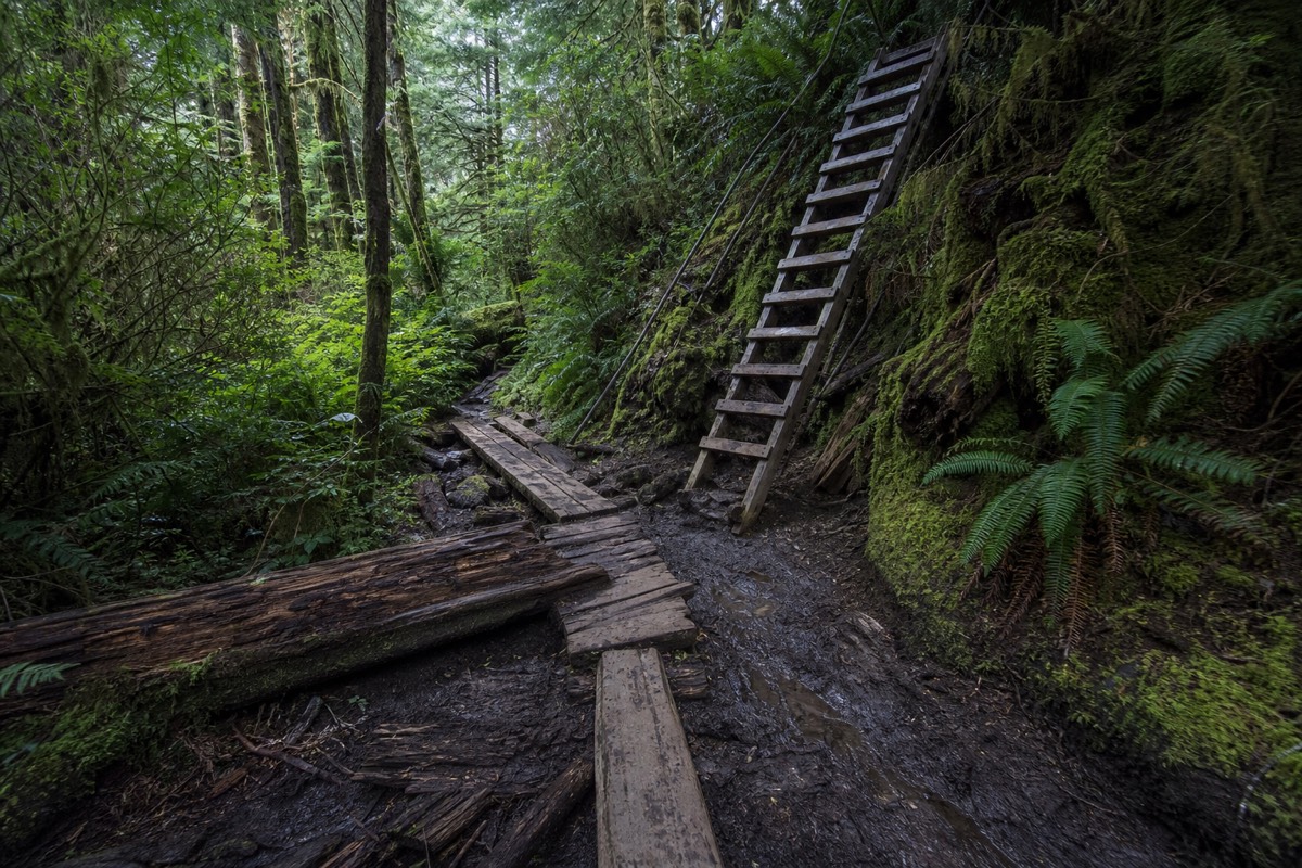
The ladders are what people remember. Long wooden runs of them, bolted to cliff faces above the surf, hauling hikers up and over the headlands where the trail cannot follow the beach. The West Coast Trail earns its reputation on features like that, and its quieter cousin to the south, the Juan de Fuca Marine Trail, offers a gentler version of the same rugged coastline. Both trace the exposed Pacific shore of southern Vancouver Island, both are managed by public agencies with real rules, and both reward the right hiker enormously. Choosing between them is the whole game, and getting the planning right is what turns a hard trip into a great one.
West Coast Trail vs Juan de Fuca, side by side
Planning allowances for the two trails, based on published route lengths and typical durations; confirm current permits and conditions before you travel.
What is the difference between the West Coast Trail and the Juan de Fuca Trail?
The West Coast Trail is a 75-kilometre backcountry route inside Pacific Rim National Park Reserve that most hikers walk over six to eight days, with a permit, a reservation and a mandatory orientation. The Juan de Fuca Marine Trail is a 47-kilometre coastal trail in a provincial park to the south, walkable end to end in three to four days or in shorter day-hike sections, with no advance permit needed for day use.
The two trails run down the same stretch of wild coast but sit under different rules and different pressures. The West Coast Trail is the serious commitment: a full backcountry expedition with ladders, cable cars, tidal crossings and a strict cap on numbers. The Juan de Fuca Marine Trail is more flexible. You can thru-hike it, or you can pick off famous sections like the suspension bridge at Mystic Beach as day walks, which makes it far friendlier to hikers who are not ready for a week in the bush.
Distance and difficulty are only part of the picture. The West Coast Trail closes for the winter and requires you to book a start date well ahead, while the Juan de Fuca coast stays open year-round for day use, though its northern sections turn to deep mud after rain. Both are governed by real agencies with published conditions, so before you set a date, read the trail reports on Parks Canada for Pacific Rim for the West Coast Trail and on BC Parks for the Juan de Fuca route. If a multi-day backcountry trek sounds like more than you want, our roundup of the best hikes on Vancouver Island covers gentler options across the whole island.
| West Coast Trail | Juan de Fuca Marine Trail | |
|---|---|---|
| Length | About 75 km end to end | About 47 km end to end |
| Typical duration | 6 to 8 days | 3 to 4 days, or day sections |
| Managed by | Parks Canada (national park reserve) | BC Parks (provincial park) |
| Permit and reservation | Required, with orientation | Not required for day use |
| Open | Seasonal, roughly May to September | Year-round for day use |
| Difficulty | Strenuous, ladders and cable cars | Moderate to strenuous, muddy |
| Best for | Experienced backpackers | Fit hikers and day walkers |
How hard is the West Coast Trail, and how long does it take?
The West Coast Trail is a strenuous multi-day backpack, and most people take six to eight days to walk its roughly 75 kilometres. Expect ladders, log crossings, hand-operated cable cars over rivers, slippery boardwalk, tidal shelf walking and long stretches of soft sand or bog. It rewards fitness, preparation and time, and it punishes anyone who underestimates it.
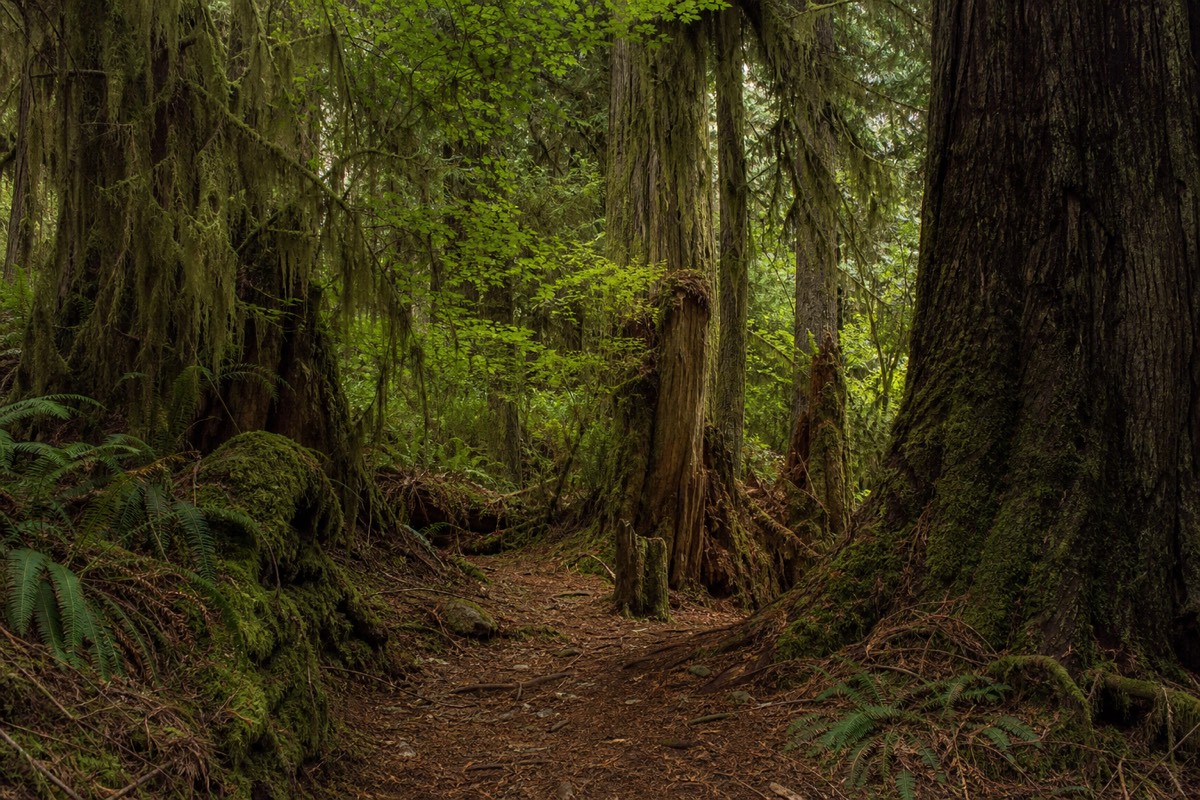
The trail runs between Pachena Bay in the north, near Bamfield, and Gordon River in the south, near Port Renfrew, tracing the shore that mariners once called the Graveyard of the Pacific. That grim name came from the shipwrecks that led the original lifesaving trail to be built along this coast, and stretches of the modern route still follow that old path. The terrain shifts constantly: forested inland sections thick with roots and mud, open beach walking timed to the tide, and the ladder-and-cable-car engineering that lets the trail cross ravines and rivers.
Plan your daily distances around the terrain rather than the map. A flat 12 kilometres on hard sand at low tide is a very different day from 12 kilometres of ladders and bog in the rain. Most parties build in a rest day or a short day, and nearly everyone finds the middle section the most physical. Because the tides dictate whether the beach route or the forest route is open, a reliable tide table for the dates you are walking is not optional, it is a core piece of trip planning. Hikers who want to feel this coastline without committing to a week can get a taste on a guided day out instead; a guided bike and hike along Tofino's surf beaches pairs an easy ride with a walk to a Pacific lookout much farther north.
The pack weight is its own factor. Carrying a week of food, a stove, a tent and enough warm, dry clothing to survive repeated soakings means most hikers set off with a heavy load, and heavy loads change how ladders, slick boardwalk and root-tangled forest feel underfoot. Trekking poles help on the descents, gaiters keep the worst of the mud out, and boots that are already broken in matter more than almost any other piece of gear. This is not a route to test new footwear or discover how your knees handle consecutive long days. Fitness built over months, not weeks, is what separates hikers who enjoy the trail from those who endure it, and a shakedown overnight with a full pack before the trip is time well spent.
| Section | Character | What to expect |
|---|---|---|
| Pachena Bay to Michigan Creek | Forest and old road bed | Gentler start, lighthouse, wide track |
| Michigan Creek to Carmanah | Beach and shelf walking | Tide-dependent, sea lions offshore |
| Carmanah to Walbran | Mixed forest and beach | Cable cars, surge channels |
| Walbran to Gordon River | Toughest inland terrain | Deep mud, ladders, roots |
Do you need a permit or reservation for the West Coast Trail?
Yes. The West Coast Trail requires an overnight backcountry permit, and the start dates book up through a reservation system that opens months ahead of the season. Every hiker must also attend a mandatory orientation before setting out. Exact fees, quotas and the reservation launch date are set by Parks Canada each year, so confirm current details on the official site rather than relying on old figures.
This is a genuinely capped trail. Parks Canada limits how many people can start each day to protect the coast and to keep the experience wild, which is exactly why the popular summer start dates disappear fast. Reservations typically open in the winter for the coming season, and the mandatory orientation covers tides, wildlife, rescue procedures and how to use the cable cars and ladders safely. Skipping the planning here is not an option, because you cannot simply turn up and walk.
Because the fees and quotas change from year to year, we deliberately do not quote a dollar figure. What matters for planning is the shape of the process: reserve a start date early, budget for the permit and the two ferry crossings that access the trailheads, and plan to arrive the day before for your orientation. For everything from the reservation window to current trail conditions and closures, work from the official Pacific Rim National Park Reserve pages, which are the only source that stays current. Reaching the trailheads is its own puzzle; if you are coming from the mainland, our guide to getting to Vancouver Island covers the ferry and floatplane options into the island.
| Requirement | What it involves | Plan ahead |
|---|---|---|
| Overnight permit | Booked per start date, capped daily | Reserve months in advance |
| Reservation window | Opens in winter for the season | Set a reminder, book early |
| Mandatory orientation | Safety and tide briefing at the trailhead | Arrive the day before |
| Trailhead access | Ferries and shuttles at each end | Coordinate with your start date |
How do you reach the trailheads, and where do you camp?
The West Coast Trail runs between two trailheads: Pachena Bay in the north, near Bamfield, and Gordon River in the south, near Port Renfrew. Both sit at the end of long, partly gravel roads, and reaching them usually means a shuttle bus and, at each end, a short boat ferry to reach the registration point. Along the route you camp at designated beach sites, carry all your own gear, and store food in the provided bear caches.
Getting to the start is a genuine part of the expedition. Most hikers pick a direction, arrange a trail shuttle between the two ends and their vehicle, and factor in that the access roads are slow. There are also small boat crossings within the trail itself, operated locally, that carry hikers over river mouths that cannot be forded, and a hand-operated cable car system at other rivers. None of this is improvised on the day: you plan your direction, your shuttle and your orientation slot together, then walk. Because the logistics reach back to the mainland, sort your island crossing early using our guide to getting to Vancouver Island.
Camping is backcountry by nature. You sleep at designated sites, most of them on the beach beside fresh water, and you pack in a stove, a tent, warm layers and everything you need to be self-sufficient for the better part of a week. Water comes from creeks and must be treated, food goes into the bear-proof storage at each camp, and you pack out everything you bring in. The reward for all that weight is waking to surf a few metres from the tent and walking a coast most people only see in photographs. If a week under canvas is more than you want, a gentler taste of the same wild shore comes on a guided ride and hike along Tofino's surf beaches farther north.
| Logistic | North end (Pachena Bay) | South end (Gordon River) |
|---|---|---|
| Nearest town | Bamfield | Port Renfrew |
| Access road | Long, partly gravel | Long, partly gravel |
| Getting between ends | Trail shuttle bus | Trail shuttle bus |
| Camping | Designated beach sites, self-sufficient | Designated beach sites, self-sufficient |
What is the Juan de Fuca Marine Trail like?
The Juan de Fuca Marine Trail is a roughly 47-kilometre coastal route in Juan de Fuca Provincial Park, running between China Beach near Jordan River and Botanical Beach near Port Renfrew. Thru-hikers usually take three to four days, but its four trailheads make it easy to walk in day sections. The scenery is superb, and the northern half is notorious for deep, ankle-swallowing mud.
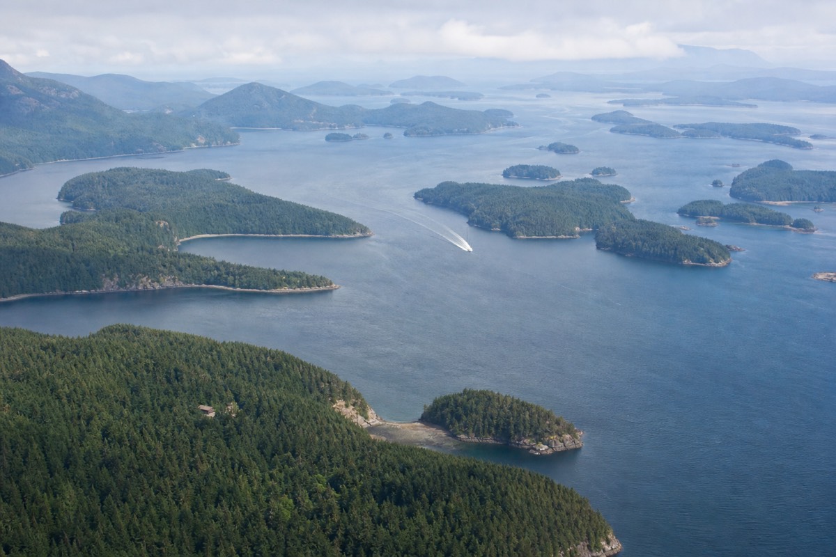
Think of the Juan de Fuca as the West Coast Trail's more accessible neighbour. It shares the same drama, waves crashing on rocky headlands, waterfalls dropping straight to the beach, old-growth forest running to the tideline, but you can sample it without a week of commitment. The trail has access points at China Beach, Sombrio Beach, Parkinson Creek and Botanical Beach, so you can hike as much or as little as you like and turn back at a road.
The famous day walks make the case for themselves. The short hike from the China Beach trailhead to the suspension bridge and waterfall at Mystic Beach is one of the most rewarding easy walks on the south island. At the southern end, the tidal shelves of Botanical Beach hold some of the best tide pools in British Columbia, best explored around low tide. In between, China Beach and Sombrio Beach reward a short walk with big sand and a surf-culture cove. This is also the coast the guided west coast tour from Victoria visits, with its ancient cedars, beaches and waterfalls, for travellers who would rather be shown the highlights than carry a pack.
| Access point | Nearby highlight | Good for |
|---|---|---|
| China Beach | Mystic Beach suspension bridge | Easy day walk, families |
| Sombrio Beach | Hidden waterfall, surf cove | Short walk, beach time |
| Parkinson Creek | Quieter mid-trail forest | Section hikers |
| Botanical Beach | Tide pools and rock shelves | Low-tide exploring |
Which trail should you choose?
Choose the West Coast Trail if you are a fit, experienced backpacker who wants a bucket-list multi-day expedition and can book months ahead. Choose the Juan de Fuca Marine Trail if you want the same wild coast with more flexibility, whether as a shorter thru-hike or a series of day walks. First-time coastal hikers and families are almost always better served by the Juan de Fuca.
Honest self-assessment matters more than ego here. The West Coast Trail is not a place to discover you are unfit or under-equipped, because evacuation is slow and expensive, and the ladders and surge channels demand respect. If you have carried a heavy pack for consecutive days, navigated tides, and want the full expedition, it delivers one of the finest coastal walks anywhere. If any of that gives you pause, the Juan de Fuca lets you meet the coast on your own terms.
There is also a middle path for travellers who want the scenery without the suffering. Southern Vancouver Island packs a lot of coast into short walks, and you can build a trip around day hikes, beach time and a guided outing or two rather than a single grinding trek. If you are basing on the west coast up north instead, an easier day among the old-growth and surf, or the boat trip to the remote geothermal pools at Hot Springs Cove, gives you the drama of this coastline with a hot soak at the end. To browse ready-made days that handle the logistics, see the range of guided west coast day tours our team arranges.
| You are | Better trail | Why |
|---|---|---|
| Experienced multi-day backpacker | West Coast Trail | The full wilderness expedition |
| Fit hiker wanting flexibility | Juan de Fuca | Thru-hike or section as you like |
| Day hiker or family | Juan de Fuca day sections | Big scenery, easy access |
| Short on time or planning | Guided day tours | Highlights without the logistics |
When is the best time to hike these trails, and how do you stay safe?
The prime window is July to September, when the weather is driest and the West Coast Trail is open. May, June and early October are quieter and workable but wetter and muddier. Whatever the month, come prepared for rain, cold surf and fast-changing conditions, carry a tide table, and never turn your back on the sea in a surge zone.
This coast makes its own weather, and even a summer forecast can flip to fog and drizzle within an hour. Waterproof boots, layers, a proper shell and a way to dry out at camp are not luxuries but survival gear on a multi-day route. The West Coast Trail's season is short by design, closing outside the roughly May-to-September window when storms make the coast dangerous, while the Juan de Fuca stays open year-round for day use but turns treacherously muddy and can flood at creek crossings after heavy rain.
The specific hazards of this coast are the ones that catch people out. Tides govern which routes are passable and can strand a hiker on a shelf or in a cove, so plan every beach section around a current tide table. Surge channels and slick rock near the water are where accidents happen, black bears and cougars live along both trails and require proper food storage and awareness, and creek crossings can rise fast after rain. For the wider wildlife picture, including why the island has black bears but no resident grizzlies, see whether there are grizzly bears on Vancouver Island. To weigh conditions across the year, our guide to the best month to visit compares the seasons for hiking and everything else.
The wildlife, though, is part of what makes these trails unforgettable rather than merely hard. Colonies of sea lions haul out on the offshore rocks along the West Coast Trail, their barking carrying across the water long before you see them, and grey and humpback whales pass close enough that hikers regularly spot spouts from the beach. Bald eagles work the tideline, and in the forest the drumming of woodpeckers and the calls of ravens replace any human noise. Seeing this from the trail is a matter of luck and patience; for a more reliable close encounter with the same coast's marine life, a boat is the answer, whether that is a whale watching cruise or the wildlife-rich crossing to the remote pools at Hot Springs Cove far to the north. Whatever you meet, keep your distance, store your food properly, and let the animals stay wild.
| Season | Conditions | West Coast Trail | Juan de Fuca |
|---|---|---|---|
| Spring (May to Jun) | Cool, wet, muddy | Opens, quieter | Muddy but walkable |
| Summer (Jul to Aug) | Driest, warmest | Peak, book ahead | Best conditions |
| Autumn (Sep to early Oct) | Mild, rain returning | Season winding down | Good, watch the mud |
| Winter (Nov to Apr) | Storms, high water | Closed | Day use only, hazardous |