Pacific Rim National Park: Long Beach, Trails, Beaches and Park Passes
The wild strip of coast between Tofino and Ucluelet holds Long Beach, old-growth boardwalks and grey whales offshore. Here is how to plan your visit, from park passes to the best trails, beaches and seasons.
Beyond Long Beach, another park unit opens by water. A Ucluelet boat transfer leads to guided Broken Group kayaking with equipment and lunch.
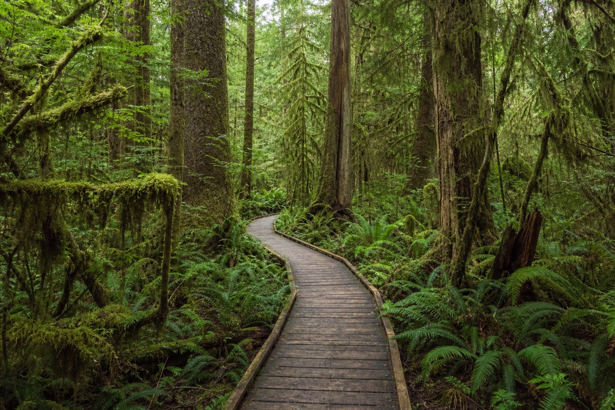
The surf on Long Beach arrives after a fetch of open Pacific that runs unbroken for thousands of kilometres, which is why the sand here feels different from any sheltered bay. Pacific Rim National Park Reserve protects around 500 square kilometres of that coastline on the west side of Vancouver Island, and most first-timers see only a sliver of what it holds. This guide walks through the units, the trails, the beaches, the passes and the seasons, so you arrive knowing exactly where to point your day.
The west coast, month by month
Planning allowances for the Long Beach area, based on typical west-coast seasons; confirm current conditions before you travel.
Where is Pacific Rim National Park Reserve, and what is in it?
Pacific Rim National Park Reserve sits on the exposed west coast of Vancouver Island, near Tofino and Ucluelet. It comes in three separate units: the road-accessible Long Beach Unit, the boat-access Broken Group Islands out in Barkley Sound, and the famous multi-day West Coast Trail in the south.
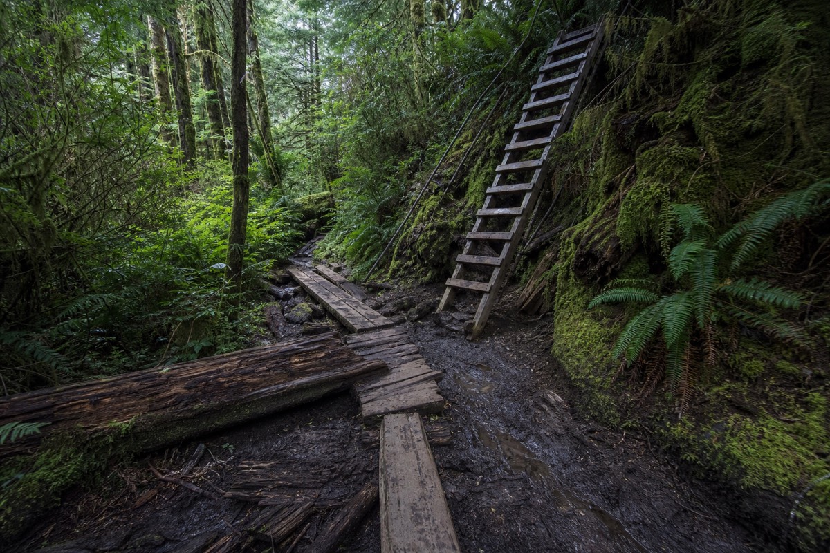
The reserve is not one fenced park with a single gate. Its three units are split by water and distance, and each asks for a different kind of trip. The Long Beach Unit is the one nearly everyone means when they say they are going to Pacific Rim: it runs along Highway 4 between the two towns, and its beaches, boardwalks and visitor centre are all reachable by car. The Broken Group Islands are a cluster of more than a hundred islets paddled by sea kayakers on multi-day trips. The West Coast Trail is a 75-kilometre backcountry route in the south, a serious hike that books out months ahead.
For a first visit, plan around the Long Beach Unit. It holds the long sand beaches, the rainforest trails, the Kwisitis Visitor Centre and the storm-watching lookouts, and it links straight to the surf town most people use as a base. If Tofino is your home for a few nights, spend an evening planning the rest of your time with our roundup of things to do in Tofino and Ucluelet, then give at least one full day to the park itself. Trip-planning details, current conditions and reservations for all three units are posted by Parks Canada on the official Pacific Rim pages.
The reserve protects a stretch of coast that has been home to Nuu-chah-nulth peoples for thousands of years, and that history runs through the park today, from the name of the Kwisitis Visitor Centre to the interpretive panels along the trails. The visitor centre itself, set above Wickaninnish Beach, is worth an hour in any weather. Its exhibits on the ocean, the rainforest and the people of this coast give the beaches and boardwalks outside far more meaning, and it is the obvious place to shelter and warm up when a squall blows through, which on this coast it often does.
| Unit | How you reach it | Time it needs | Best for |
|---|---|---|---|
| Long Beach Unit | By car on Highway 4 | Half a day to two days | First visits, beaches, easy trails |
| Broken Group Islands | By boat or sea kayak from Barkley Sound | Two to five days | Experienced paddlers, wilderness camping |
| West Coast Trail | On foot, multi-day, permit required | Six to eight days | Fit backpackers booking well ahead |
Do you need a park pass for Pacific Rim, and what does it cost?
Yes. If you stop anywhere in the Long Beach Unit you need a valid Parks Canada pass displayed in your vehicle. You can buy a day pass or an annual Discovery Pass, sold at machines and the visitor centre. Youth 17 and under usually enter free, and rates change each year, so confirm the current price before you go.
The pass is enforced. Parking lots at Long Beach, Wickaninnish and the trailheads have pay stations, and compliance patrols do check. A day pass covers the calendar day, so if you are staying in Tofino for three nights and visiting the park on two of them, price out the annual Discovery Pass, which pays for itself quickly across a longer trip or a summer of national-park stops.
The pass is not a road toll. Driving straight through on Highway 4 between Tofino and Ucluelet without stopping does not require one. The moment you pull into a park lot or step onto a park beach, it does. We do not quote a figure here because the daily adult, family and annual prices are updated yearly and posted on the Parks Canada site.
| Pass | Covers | Best for | Where to buy |
|---|---|---|---|
| Daily pass | One calendar day in the Long Beach Unit | A single day visit | Pay machines at park lots and the visitor centre |
| Discovery Pass (annual) | A year at national parks across Canada | Multi-day stays and repeat visits | Parks Canada online or on site |
| Youth 17 and under | Admission at no charge (confirm current policy) | Families | No purchase needed |
What are the best trails in the Long Beach Unit?
The two standouts are the Rainforest Trail, a pair of boardwalk loops through towering old-growth cedar and hemlock, and the Shorepine Bog Trail, a short loop through a strange dwarf forest growing on deep peat. Add the South Beach Trail from Kwisitis for a cobble cove that booms with surf on a big day.
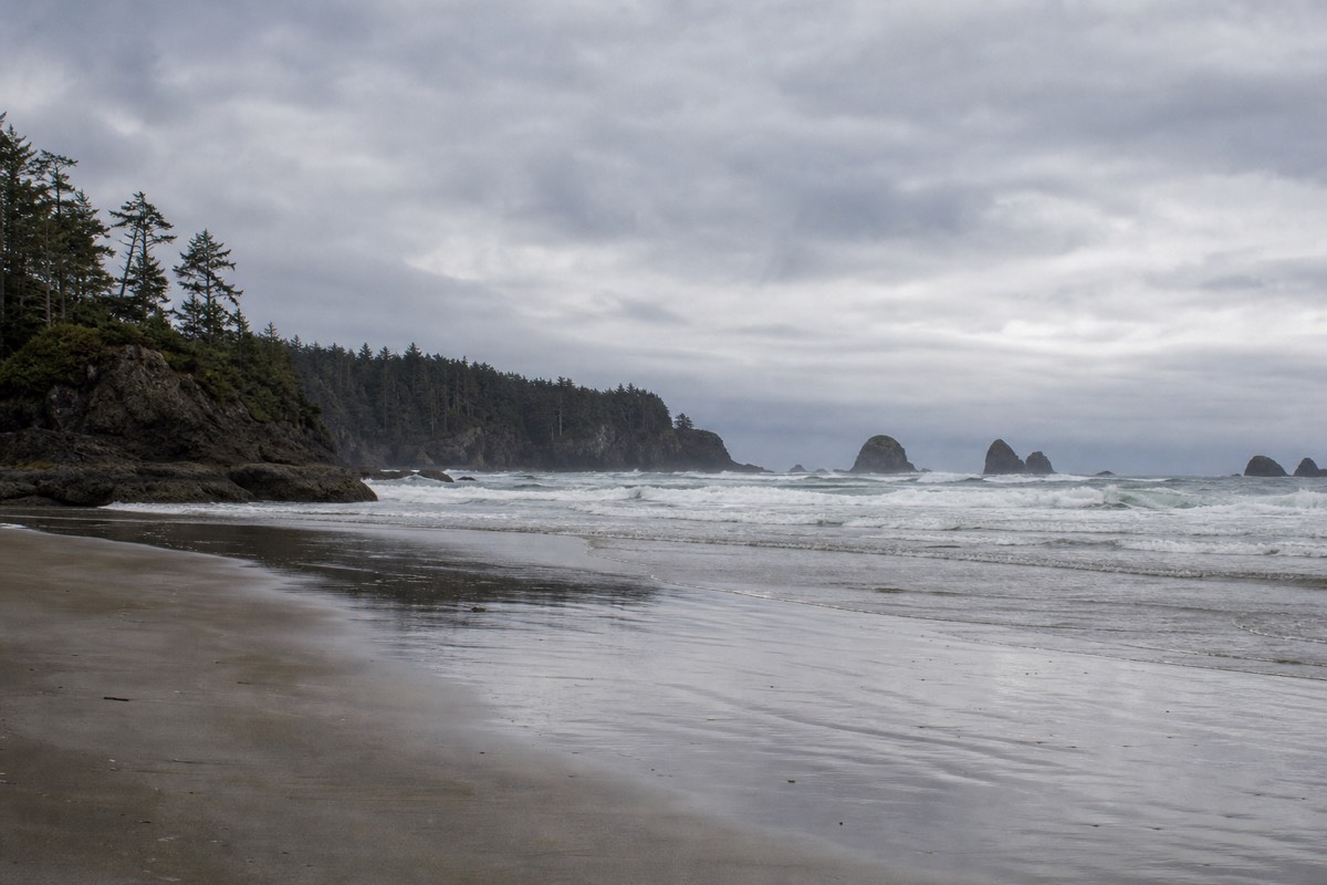
The Rainforest Trail has two loops, each roughly a kilometre, on opposite sides of the highway. Both are raised cedar boardwalk, which keeps you above the saturated forest floor and protects the roots of trees that have stood for centuries. Go slowly. The scale of the canopy does not read in a hurried walk, and the light through the moss shifts completely depending on whether it is drizzling or bright.
The Shorepine Bog Trail is the odd one, and often the most memorable. A boardwalk loop of under a kilometre circles a bog where waterlogged, acidic peat starves the shore pines of nutrients, so century-old trees stay knee to shoulder height. It is a bonsai forest made by drainage rather than by hand, and the interpretive signs explain the ecology well. The South Beach Trail runs a short distance from the Kwisitis Visitor Centre down to a cobble beach where the swell funnels in and detonates against the rocks; stay well back from the surge zone. Longer options include the Nuu-chah-nulth Trail linking Kwisitis and Florencia Bay, and the Schooner Cove Trail that drops through forest to a quieter stretch of Long Beach.
Whichever trails you pick, dress for wet feet and low light. The rainforest here takes several metres of rain a year, and even the boardwalks can be slick, so grippy footwear matters more than fashion. Photographers tend to prefer an overcast or drizzly day for the forest loops, when the greens saturate and the harsh contrast of direct sun disappears; save the clear days for the beaches. Each trail is short enough that you can walk two or three in a single morning, then give the afternoon over to the sand and the surf.
| Trail | Length (allow) | Terrain | Highlight |
|---|---|---|---|
| Rainforest Trail (two loops) | About 1 km each; 30 to 45 min | Elevated cedar boardwalk | Old-growth canopy and moss |
| Shorepine Bog Trail | Under 1 km; 20 to 30 min | Flat boardwalk loop | Dwarf bog forest |
| South Beach Trail | Short; 20 to 30 min return | Forest path to cobble beach | Surf booming on cobbles |
| Nuu-chah-nulth Trail | About 2.5 km one way | Forest and headland | Links Kwisitis to Florencia Bay |
| Schooner Cove Trail | About 1 km one way | Forest steps to sand | Quiet north end of Long Beach |
Which beaches should you visit inside the park?
Long Beach is the headline act: roughly 16 kilometres of open sand and rolling surf, the longest beach on this coast. Wickaninnish and Combers beaches sit at its south end near the visitor centre, while Schooner Cove and the surf-school break at Incinerator Rock give you quieter sand and the gentlest waves for beginners.
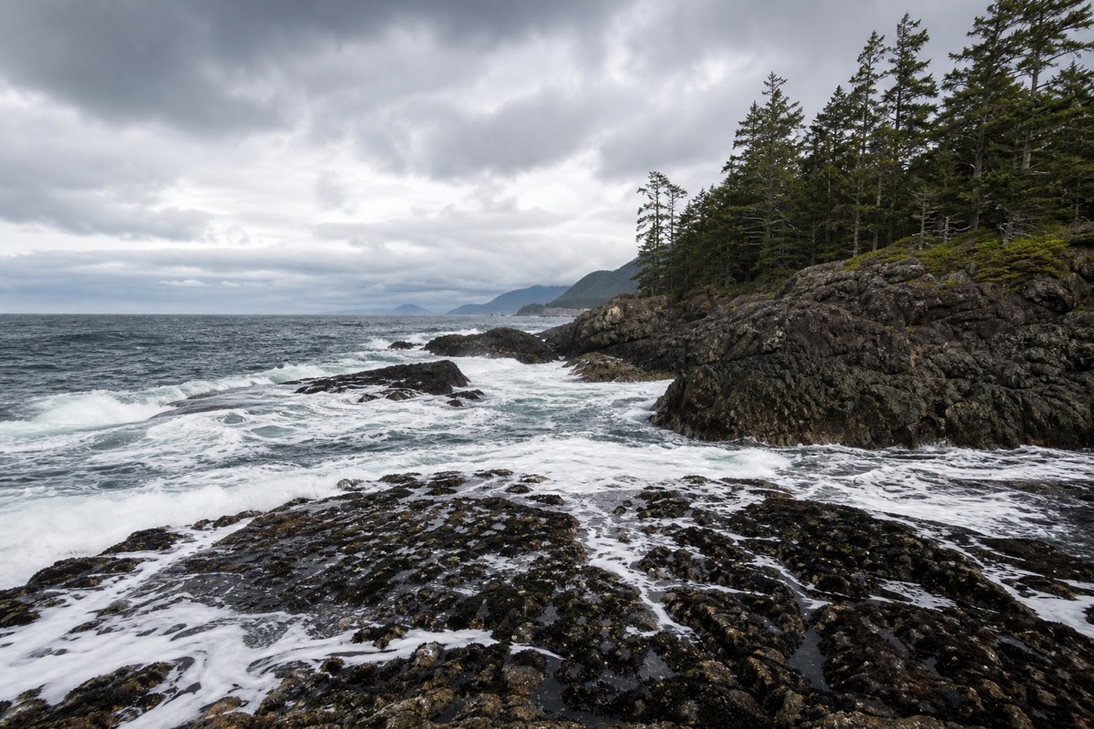
Long Beach is not one parking lot but several access points strung along Highway 4, each opening onto the same vast sweep of sand. Combers Beach and Wickaninnish Beach, near the Kwisitis Visitor Centre, are the classic storm-watching and sunset spots, with driftwood logs the size of telephone poles thrown up the beach by winter swells. Incinerator Rock is the surf-lesson end, where the waves are gentler and the lineup is friendliest to first-timers.
Tide matters more here than most people expect. At low tide Long Beach becomes a shining flat wide enough to lose your friends on; at high tide with a winter swell the usable beach narrows fast and the logs shift. Check a tide table for the day, keep off wet dark rock in the surge zone, and never turn your back on the sea when it is running big. If you want to ride those waves rather than watch them, our guide to surfing in Tofino covers beaches, seasons and wetsuits. To rank the sand against the rest of the island, see our roundup of the best beaches on Vancouver Island.
| Beach | Where | Best for | Note |
|---|---|---|---|
| Long Beach | Along Highway 4, mid-park | Walking, surf, big-sky views | Roughly 16 km of open sand |
| Wickaninnish Beach | By the Kwisitis Visitor Centre | Storm watching, sunsets | Interpretive centre on site |
| Combers Beach | South end | Driftwood, long walks | Watch for surge on big days |
| Incinerator Rock | North of Wickaninnish | Beginner surf | Popular with surf schools |
| Schooner Cove | North end, short trail | Quiet sand | Forest walk in |
| Florencia Bay | Near Kwisitis | Beachcombing | Reached via the Nuu-chah-nulth Trail |
What wildlife will you see, and when?
Grey whales pass close offshore on their spring migration, humpbacks feed through summer and autumn, and black bears forage the shoreline of nearby Clayoquot Sound at low tide. Bald eagles, sea lions, harbour seals and sea otters are year-round regulars. A guided boat is the reliable way to see the bears and whales up close.
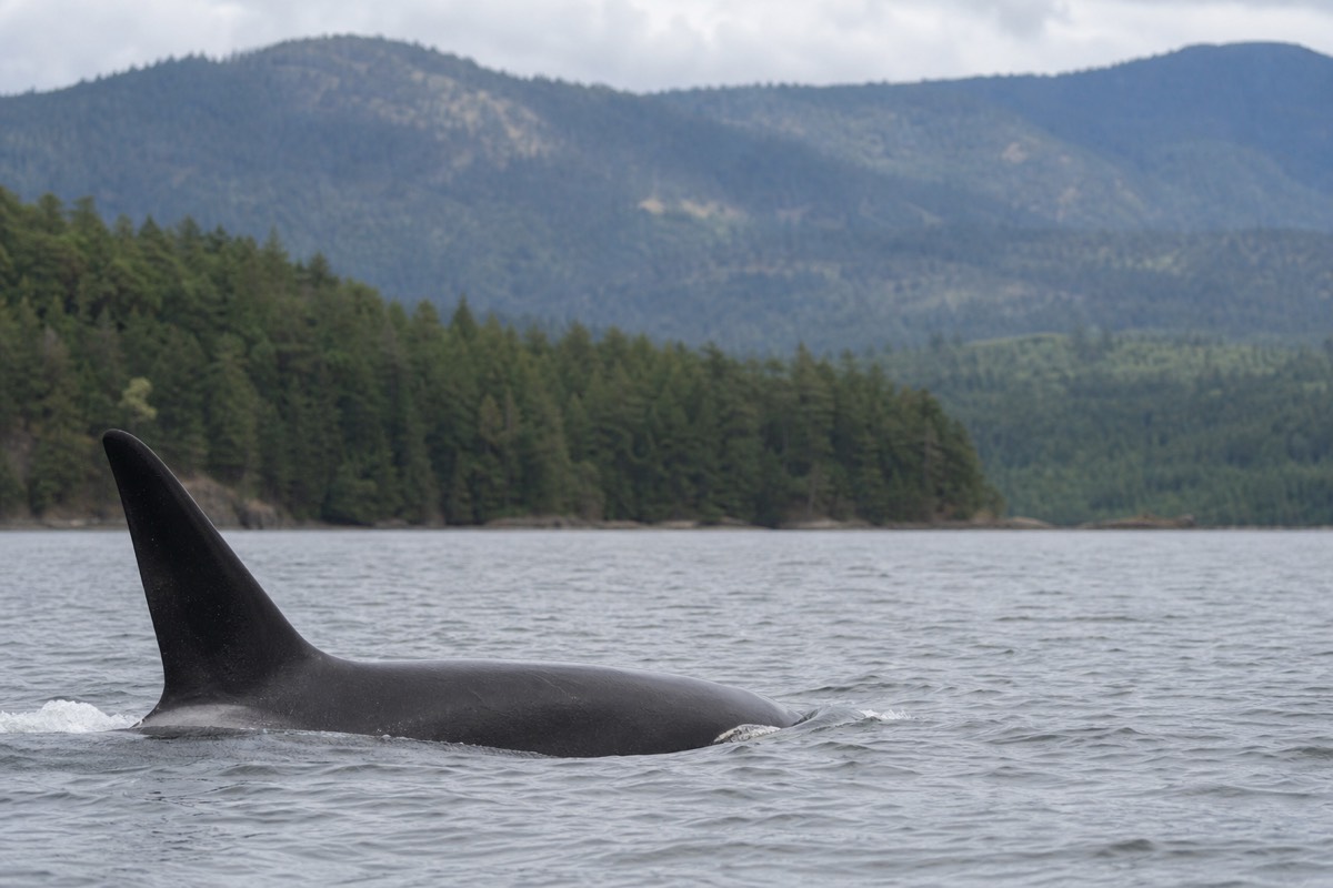
The grey whale migration is the seasonal headline. Thousands of grey whales travel north past this coast, mostly from March into May, and some linger through summer to feed in the shallows off Tofino and Ucluelet. Humpbacks have become far more common in recent years, and by late summer their feeding in the surrounding waters is dependable enough that operators build tours around it. For where to launch, which season suits which species and what to expect on the water, see our full guide to whale watching on Vancouver Island.
The park's forests and the sheltered inlets just north of it hold a healthy population of coastal black bears, which come down to the tideline to flip rocks for crabs and other food as the water drops. This is best seen from a boat, both for the sightlines and for the bears' sake. A guided bear watching cruise in Clayoquot Sound puts a naturalist between you and the shore and keeps a respectful distance, which is safer and more considerate than trying to find bears on foot. To understand the wider picture, including why the island has black bears but no resident grizzlies, read whether there are grizzly bears on Vancouver Island.
Autumn adds another layer to the wildlife calendar. As salmon return to the coastal streams from late summer into fall, they draw black bears down to the water and gather bald eagles along the rivers and estuaries, and the same abundance feeds the seals and sea lions offshore. That is why September and October, though wetter, rank among the richest months for wildlife on this coast. Whenever you come, carry binoculars, keep a respectful distance from every animal, and never feed or approach wildlife, both for your safety and for theirs.
| Wildlife | Best months | Where to look | How to see it |
|---|---|---|---|
| Grey whales | March to May | Offshore, from beaches and boats | Boat tour or clifftop watch |
| Humpback whales | July to October | Feeding grounds offshore | Boat tour |
| Black bears | Spring and autumn, low tide | Clayoquot Sound shoreline | Guided boat cruise |
| Bald eagles | Year-round | Shoreline snags and tideline | Naked eye, binoculars help |
| Sea lions and seals | Year-round | Rocks and haul-outs | Boat tour |
| Sea otters | Year-round | Kelp beds offshore | Boat tour, binoculars |
When is the best time to visit Pacific Rim?
For sun and long days, come in July and August, but expect the busiest beaches and fullest lots. May, June and September give the best balance of decent weather, whales offshore and fewer people. From November to February the coast turns to storm-watching season, with huge surf and almost no crowds.
The west coast makes its own weather. Even a bright summer forecast can turn to fog and drizzle by mid-morning and clear again by afternoon, so layers and a waterproof shell earn their place in your pack whatever the month. Summer brings the warmest, driest stretch and the peak of humpback activity, along with the tightest accommodation. May and June catch the tail of the grey whale migration and the fresh green of the rainforest, with far more room to breathe.
Winter is this coast's quiet triumph. From November through February the North Pacific throws storm after storm at the shore, and the same beaches that draw sunbathers in August become theatres for waves that can top several metres. Lodges sell packages around it, and the trick is a room with an ocean view, proper rain gear, and the discipline to watch the biggest sets from well back. Our guide to Tofino storm watching covers the season in detail.
| Season | Weather | Wildlife | Crowds | Verdict |
|---|---|---|---|---|
| Spring (Mar to May) | Cool, changeable | Grey whale migration | Light | Great for whales, quiet trails |
| Summer (Jun to Aug) | Warmest, driest | Humpbacks building | Busiest | Best weather, book ahead |
| Autumn (Sep to Oct) | Mild, some rain | Humpbacks, bears on salmon | Easing | Best all-round balance |
| Winter (Nov to Feb) | Wild storms, rain | Fewer sightings | Quietest | Storm watching, cosy stays |
How do you get to Pacific Rim National Park?
The Long Beach Unit sits on Highway 4, west of Port Alberni. From Victoria it is about 315 kilometres and four to four and a half hours of driving; from Nanaimo it is closer, around two to two and a half hours. Most mainland visitors cross to the island first by ferry or floatplane, then drive west.
There is no bridge and no direct road from the mainland, so reaching the park means getting onto Vancouver Island first. The most common route is a ferry crossing, with BC Ferries running the busy Tsawwassen to Swartz Bay sailing near Victoria and the Horseshoe Bay to Departure Bay sailing into Nanaimo, each about an hour and a half on the water. From Nanaimo you are already halfway to the coast, which is why many road-trippers aim for that terminal rather than the Victoria one.
Highway 4 is the only road in, and its final stretch over the mountains to the coast is narrow, winding and occasionally closed for construction or weather, so build in buffer time and fuel up before you leave Port Alberni. If you would rather someone else took the wheel for the long haul from the city, a private two-day trip from Vancouver to Tofino folds the ferry, the drive and a stop among the old-growth giants of Cathedral Grove into one package. Planning your own route instead? Our Vancouver Island road trips guide maps the drive stop by stop.
Once you are on the island, the drive itself is part of the trip. Highway 4 climbs past Cameron Lake, threads through the old-growth of Cathedral Grove and drops through Port Alberni before the mountain crossing to the coast, so leave time for stops rather than treating it as dead mileage. There is no fuel and there are no services on the long forested stretch between Port Alberni and the coast, so top up the tank and grab supplies before you leave town. Cell coverage is patchy along here, which is one more reason to download maps before you set out.
| From | Distance (allow) | Drive time (allow) | Notes |
|---|---|---|---|
| Victoria | About 315 km | 4 to 4.5 hours | Scenic, winding final stretch |
| Nanaimo | About 210 km | 2 to 2.5 hours | Closest ferry gateway |
| Vancouver (via ferry) | Ferry plus about 210 km | Most of a day | Cross to Nanaimo, then Highway 4 |
| Port Alberni | About 130 km | Under 2 hours | Last major fuel and supplies |
Should you explore Pacific Rim on your own or with a guide?
The beaches, trails and visitor centre are easy to enjoy independently once you have a park pass and a tide table. Guides earn their keep for the things you cannot reach or read on your own: bears on the tideline, whales offshore, and the remote geothermal pools up the coast that no road can reach.
Self-guided is the right call for most of a park day. You can walk Long Beach, loop the Rainforest Trail and the bog, watch the surf at Wickaninnish and read the exhibits at Kwisitis without booking anything but your pass. The park is well signed and the trails are short. Rent a car, check the tides, pack layers and go.
Timing helps as much as planning. Whatever you do, aim for a morning start: the wind is usually lightest early, wildlife tends to be more active, and the light on the beaches is at its best before the afternoon haze rolls in. Book any boat tour ahead in summer, when the small-group departures fill from confirmed reservations, and build a flexible buffer into your day, because sailings and conditions on this coast shift with the weather.
The exceptions are on the water. To see coastal black bears foraging at low tide, to get out among humpbacks, or to reach the remote Hot Springs Cove and its ocean-edge pools, you need a boat and, ideally, a naturalist reading the shoreline for you. If cycling and hiking the coast with a local is more your speed, the bike and hike the wild coast of Tofino outing pairs beach cruisers with a walk to a Pacific lookout. You can compare pickup times and live prices on each listing, and browse the full range of guided day tours on the west coast from one place.
However you visit, treat the park as a place to slow down rather than tick off. One unhurried day on Long Beach, a bog loop in the drizzle and a boat morning with the bears will stay with you far longer than a rushed lap of every parking lot. And if the question of whether you can simply drive to those famous pools is nagging at you, we answer it plainly in can you drive to Hot Springs Cove.