Botanical Beach Tide Pools: Tides, Timing & the Trail
Botanical Beach is the finest tidepooling on Vancouver Island, but only for the few hours around low tide. Here is the tide height to aim for, when to go, the trail down, and what you will find in the pools.
See Botanical Beach without driving Highway 14 yourself. A private Victoria day includes Botanical Beach and Port Renfrew. Explore the guided Port Renfrew coast
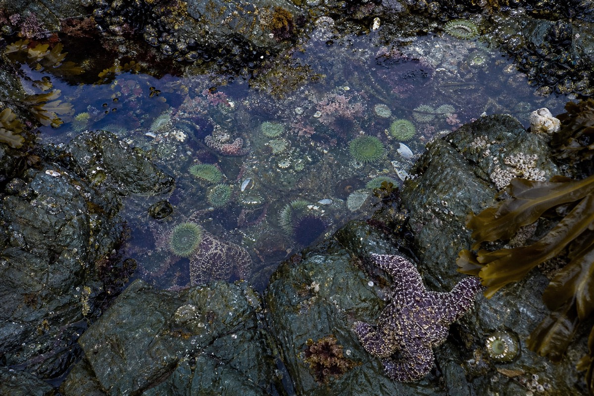
Show up at Botanical Beach at the wrong hour and you will see a pretty rocky shore and wonder what the fuss is about. Show up on a low tide of about a metre and the same shore turns inside out: sandstone and basalt shelves emerge from the water, and the pools left behind fill with anemones, sea stars, urchins and darting sculpins in a living cross-section of the intertidal zone. This beach is entirely a creature of the tide. Get the timing right and it is the best tidepooling on Vancouver Island; get it wrong and you have driven two hours to look at wet rock. This guide is built around getting the timing right.
Time your visit to the low tide
How much of the reef you can explore at Botanical Beach depends on tide height; these bands are a planning guide, so check a current Port Renfrew tide table before you drive out.
Where is Botanical Beach and how do you reach it?
Botanical Beach sits just past Port Renfrew at the western end of Highway 14, roughly two to two and a half hours from Victoria. It marks the far end of the Juan de Fuca Marine Trail. From the day-use parking lot, a short forest trail of about fifteen to twenty minutes drops you onto the rock shelves.
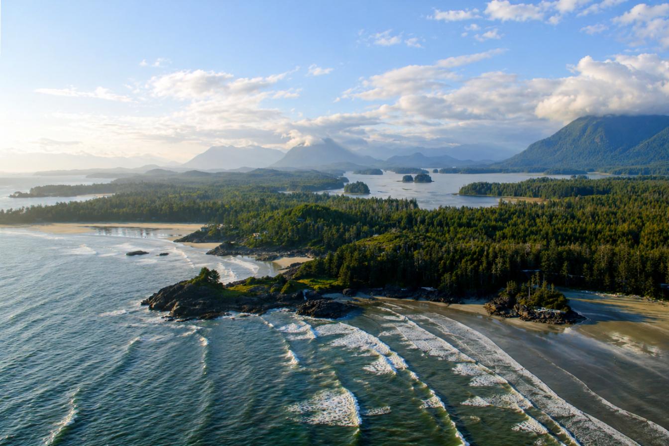
Highway 14, the West Coast Road, runs from Victoria out through Sooke and along the coast to Port Renfrew, the small town that serves as the base for Botanical Beach. It is a winding two-lane road, scenic but slow, so give it more time than the distance suggests. Port Renfrew has fuel, a pub, a few places to eat and limited lodging, and it doubles as the gateway to some of the island's most famous old-growth trees, including Avatar Grove, which our guide to the old-growth forests of Vancouver Island maps in full. Fuel up before you leave Sooke, and expect patchy cell coverage the whole way, so download your tide table in advance. For the wider question of reaching the island, see getting to Vancouver Island.
The beach is part of Juan de Fuca Provincial Park, managed by BC Parks, and the current access and closure notes live on the official BC Parks site. Day use is free. The lot has pit toilets and fills on sunny summer weekends, especially when a good daytime low tide draws a crowd, so an early arrival helps on both counts.
| From | Approx distance | Allow (drive) | Notes |
|---|---|---|---|
| Victoria | About 105 km | 2 to 2.5 hrs | Via Sooke on Highway 14 |
| Sooke | About 70 km | 1.25 to 1.5 hrs | Last fuel and reliable cell service |
| Port Renfrew | About 5 km | 10 min | Nearest food, fuel and lodging |
| China Beach trailhead | About 45 km | 45 to 55 min | Eastern end of the marine trail |
When do the tide pools appear, and how do you time your visit?
The pools reveal themselves only around low tide. Aim for a low tide of about 1.2 metres or lower, and the lower the number, the more shelf you can explore. Check a current tide table for Port Renfrew, arrive about an hour before the predicted low, and give yourself the window on either side of it before the water returns.
This is the single fact that makes or breaks the visit. At high tide the sea covers the shelves completely and there is nothing to see; as the tide drops past roughly 1.2 metres the rock emerges and the pools open up; at a very low tide of half a metre or less the whole reef is walkable and the tidepooling is at its best. Tide tables give predicted heights and times for each day, and the good windows do not fall at convenient hours every day, which is exactly why planning matters here more than at any other beach on the coast. Treat the tide heights as a planning guide and always check the current table before you drive out, because weather and pressure can shift the real water level from the prediction.
Arrive an hour before the predicted low so you can walk out as the water pulls back, then keep an eye on the turn. Once the tide starts rising it comes back across the flat shelves faster than people expect, and it can cut off the outer rocks. Never turn your back on the surf on the exposed outer reef, and step back well before the water reaches you. This same tide discipline applies up and down the coast, and our best beaches on Vancouver Island guide flags every beach where it matters.
| Tide height (approx) | What is exposed | Verdict |
|---|---|---|
| 0.6 m or lower | Full shelves and outer reef | Best, plan for this |
| About 1.2 m | Most pools reachable | Good |
| About 1.8 m | Upper pools only | Fair, limited |
| 2.5 m or higher | Shelves submerged | Skip, come back at low tide |
What lives in the Botanical Beach tide pools?
The pools hold a dense community of intertidal life: green and red anemones, purple and orange sea stars, spiny sea urchins, gooseneck barnacles, chitons, mussels, hermit crabs and small fish called sculpins darting for cover. Offshore, seals, sea lions, eagles and, in season, passing whales add to the show.
Crouch beside a single pool for a minute and what looked like bare rock resolves into movement. Hermit crabs shift their borrowed shells, sculpins flick between crevices, and the walls come alive with the grip of sea stars and the slow fan of anemones opening underwater. The variety here is what drew scientists in the first place: a marine research station operated at Botanical Beach in the early 1900s, and biologists have studied the shore ever since, as the shore's documented history records. It remains one of the richest and most accessible intertidal zones on the Pacific coast.
The rock itself is part of the story. The dark shelves are sandstone and basalt, and their surfaces are dimpled with smooth, round potholes ground out over centuries by boulders swirling in shallow depressions. Those hollows hold water as the tide drops, which is why the pools here are so numerous and so deep, and it is worth pausing to notice how the shape of the rock creates the habitat you came to see. Tread carefully across the shelves, because the same algae that feeds the pools makes the rock slick underfoot.
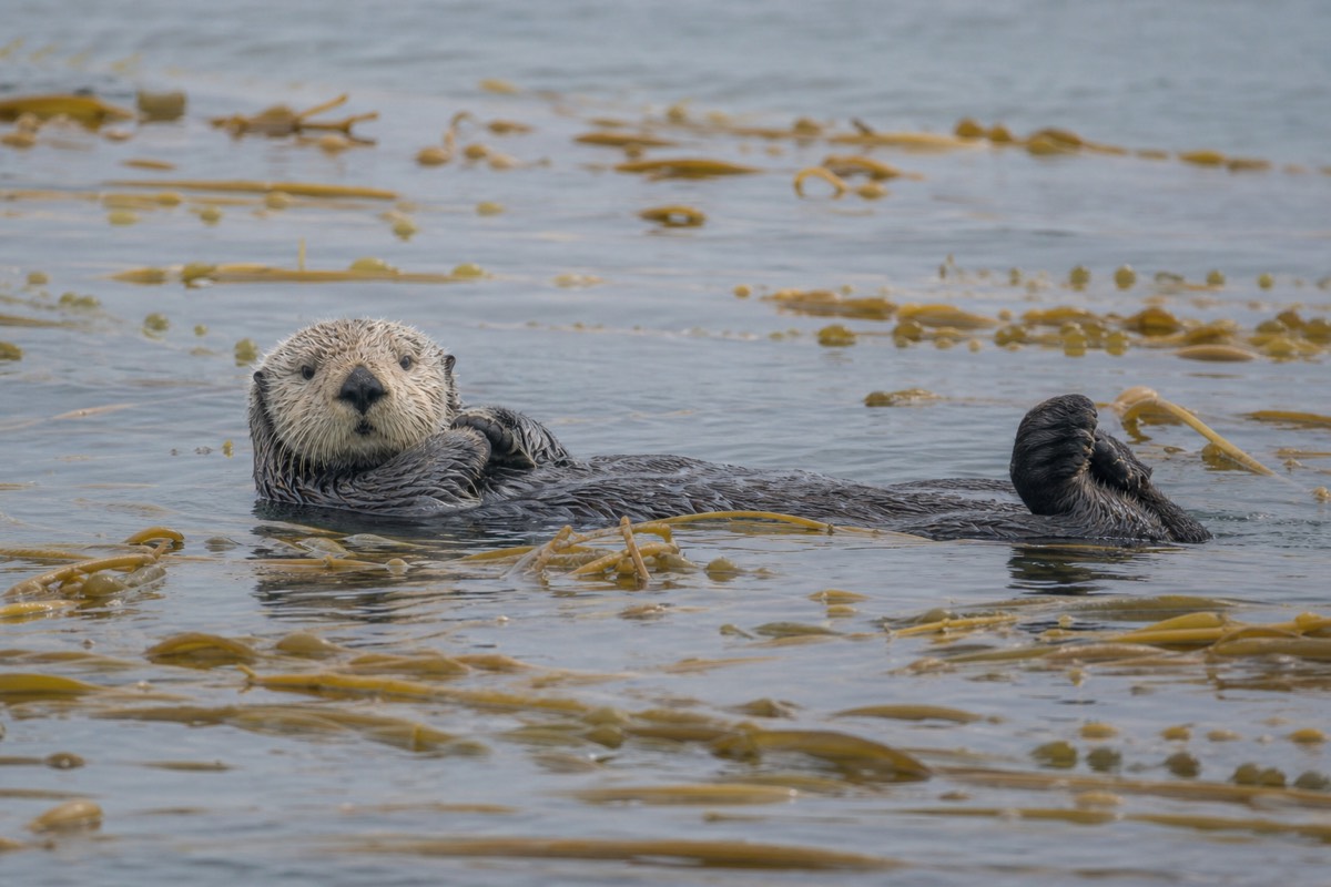
The wildlife is not confined to the pools. Harbour seals haul out on the offshore rocks, Steller sea lions bark from the reefs, bald eagles work the tideline, and grey and humpback whales pass offshore during their migration seasons, which our guide to whale watching on Vancouver Island covers in detail. Bring binoculars and give the water a scan between pools; the same low tide that opens the reef often coincides with feeding activity just offshore.
| What to look for | Where | Tip |
|---|---|---|
| Anemones and sea stars | Pool walls and shelf sides | Look, do not pry them off |
| Sea urchins and chitons | Deeper pools and cracks | Watch, do not touch |
| Sculpins and small fish | Clear pools with sandy bottoms | Stay still and wait |
| Hermit crabs | Shallow pools | Return any shell you lift |
| Seals, sea lions, eagles | Offshore rocks and the tideline | Bring binoculars |
What are the trails at Botanical Beach?
A short access trail of about fifteen to twenty minutes leads from the parking lot down to Botanical Beach itself. A longer loop of roughly three kilometres links Botanical Beach with neighbouring Botany Bay, running along the shore one way and back through coastal forest, giving you both coves and the connecting headland in one walk.
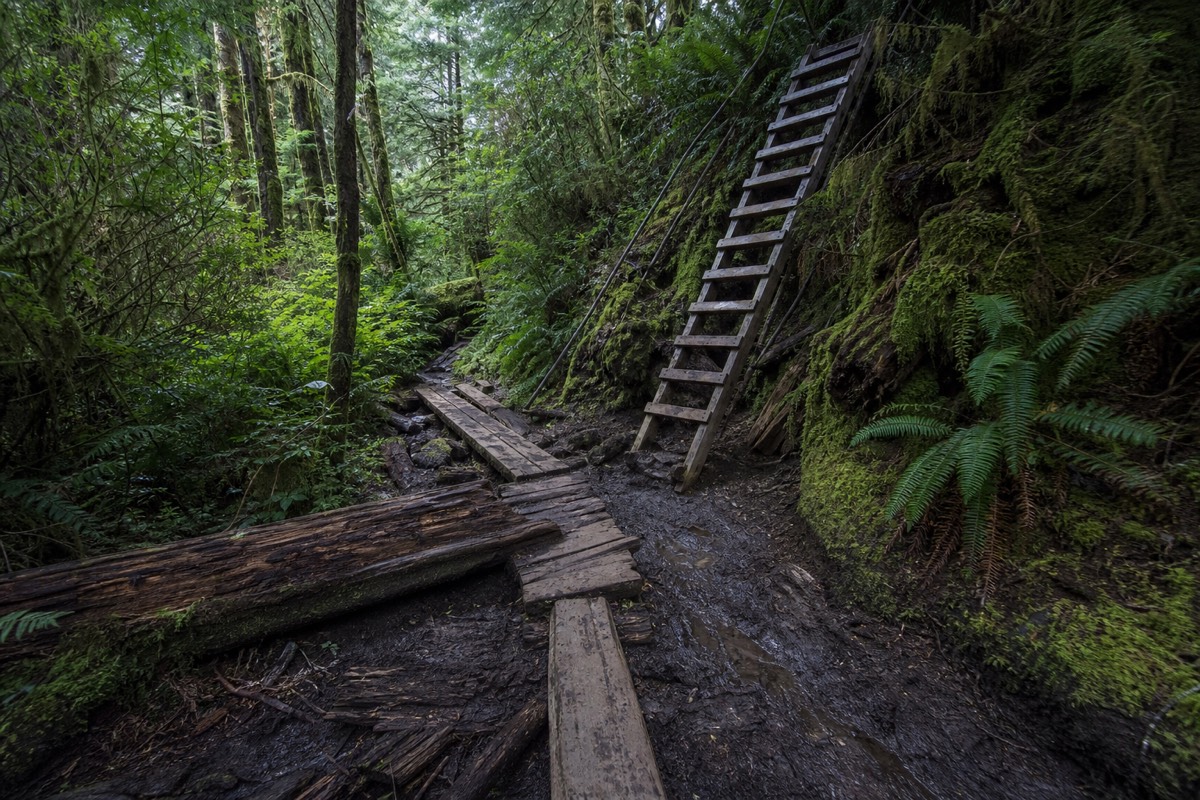
Most visitors take the direct access trail, a rooty forest path that ends with a short descent onto the rock shelves. If you have more time and a good low tide, the loop is the better outing. Botany Bay, the cove to the west, has its own tide pools, tumbled boulders and views out to the open strait, and the shoreline stretch between the two coves is where the sandstone weathering is at its most dramatic. Walk the shore section only near low tide, and return through the forest as the water rises. The forest here is worth slowing for in its own right, and if big trees are your thing, the trailheads for Port Renfrew's famous old growth are minutes away by car.
Footwear matters as much here as anywhere on the coast. The shelves are slick with algae, the pools are edged with sharp barnacles, and the forest path stays muddy long after rain, so grippy shoes or light boots beat sandals. Tread on bare rock and sand rather than on the living carpet of mussels and barnacles, both to protect the shore and to keep your own footing. This walk pairs naturally into a wider coastal drive, and our Vancouver Island road trips guide strings the Highway 14 coast into a longer itinerary.
| Trail | Distance | Character |
|---|---|---|
| Botanical Beach access | About 15 to 20 min each way | Direct forest path to the shelves |
| Botany Bay access | About 10 to 15 min each way | Short path to the neighbouring cove |
| Botanical loop | Roughly 3 km | Shore one way, forest back, both coves |
When is the best season to visit Botanical Beach?
Late spring through summer is best, not because the tide is lower then but because that is when the very low tides tend to fall during daylight and warmer weather. May, June, July and August combine the most convenient daytime lows with the friendliest conditions. Winter has excellent lows too, but many arrive after dark or in cold rain.
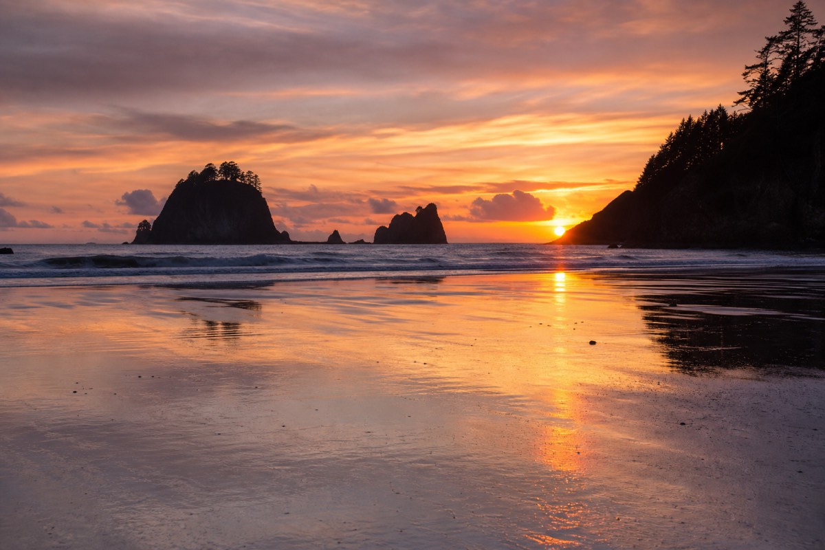
Tide height follows the moon, not the calendar, so big low tides happen year-round. What changes with the season is when they occur. Through late spring and summer the lowest daytime tides line up with long, often dry days, which is why this is the prime tidepooling window and also the busiest. The shoulder edges of spring and autumn still deliver good daytime lows with far fewer people, so if you can be flexible with your date, pick the day the tide table favours rather than the day the calendar suggests. For the broader seasonal picture across the island, see our notes on the best month to visit Vancouver Island.
Whatever the season, dress for the coast rather than the forecast. This shore faces the open Strait of Juan de Fuca and can turn grey, windy and cold within an hour of sunshine, so layers and a waterproof shell belong in the bag even in July. The reward for reading the tide table and the sky correctly is a few hours on one of the most alive stretches of shoreline in the country, and current conditions and seasonal notes are worth a look on the island tourism site before you go.
| Season | Daytime lows | Crowds | Verdict |
|---|---|---|---|
| May to Jun | Good, in daylight | Moderate | Excellent balance |
| Jul to Aug | Best daytime lows | Busy | Prime, arrive early |
| Sep to Oct | Good, cooling | Quieter | Quiet and rewarding |
| Nov to Apr | Some lows after dark | Very quiet | Check tide times carefully |
How do you protect the tide pools and stay safe?
Look, do not take. Leave every creature where it lives, put back anything you lift, and step on bare rock or sand rather than on mussels and barnacles. For safety, keep off the outer reef when surf is up, watch the rising tide, and wear grippy footwear on the slick shelves.
The tide pools stay rich only because most visitors treat them gently, and a single careless afternoon can undo years of growth. Do not pry animals off the rock, do not stack them for photos, and do not collect shells that a hermit crab may still need. Keep sunscreen and bug spray out of the pools. The rule is simple: observe closely, disturb nothing, and leave the shore exactly as you found it.
Safety comes down to the tide and the surf. The outer shelves take the full force of the open Pacific, sneaker waves can wash across low rock without warning, and the returning tide moves quickly over the flats. Stay well back from the surf line, never turn your back on the sea on the exposed reef, and start heading in before the water reaches you. Keep children within arm's reach on the wet rock. These are the same habits that keep every wild beach on this coast safe, and our companion guide to Mystic Beach and the Juan de Fuca day hike spells out the tide discipline for the neighbouring coves.
| Do | Do not |
|---|---|
| Step on bare rock and sand | Walk on mussel and barnacle beds |
| Observe animals in place | Pry, stack or collect creatures |
| Return any shell or rock you lift | Take shells or stones home |
| Watch the surf and the rising tide | Turn your back on the sea on the reef |
| Wear grippy footwear | Explore the shelves in sandals |
How does Botanical Beach compare, and should you take a tour?
Botanical is the tidepool beach; the other Juan de Fuca beaches offer different rewards. Mystic Beach is the wild hike to a waterfall, China Beach is the easy sandy stroll, and Sombrio is the surf spot with a hidden canyon. Independent visitors with a car and a tide table do Botanical best, but a guided day out handles the drive and the timing.
Because all four beaches sit off the same highway, a well-timed day can pair Botanical's afternoon low tide with a morning at one of the others. See our guides to China Beach and Sombrio and the island's best beaches to plan the combination. The self-drive version rewards you with total control over your timing, which on this tide-ruled shore is the whole game. Bring the tide table, start early, and treat the winding highway with respect.
If you would rather not drive the coast or juggle the tide yourself, a guided west coast seals, rainforest and waterfall day tour from Victoria works this same stretch near Port Renfrew, pairing beach time with a walk among thousand-year-old cedars and possible seal, sea lion and eagle sightings, with the timing handled for you. Travellers who care most about old growth and waterfalls rather than tide pools might prefer the Cathedral Grove, Coombs and waterfalls full-day tour instead, and you can compare the full range of guided nature day tours across the island in one place.
| Beach | Best for | Timing | From Victoria |
|---|---|---|---|
| Botanical Beach | Tide pools, wildlife | Low tide only | 2 to 2.5 hrs |
| Mystic Beach | Waterfall, wild cove | Any, best at low tide | 1 to 1.5 hrs |
| China Beach | Easy sand, families | Any tide | 1 to 1.5 hrs |
| Sombrio Beach | Surf, waterfall canyon | Any, surf varies | 1.5 to 2 hrs |